Tso Moriri: Hiking the Shores of Ladakh’s Azure Lake
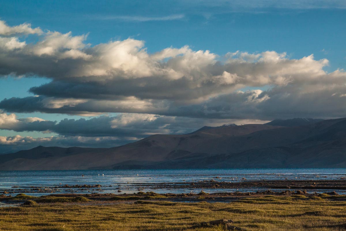
There’s a particular kind of stillness that settles over a person sitting alone on a rise above Tso Moriri, watching its impossibly deep blue stretch toward the horizon while a bitter wind cuts through the midday heat of high altitude. In that moment, it genuinely felt like some long, unfinished loop had finally closed.
Five years earlier, I’d stood on that exact spot, back when it was still the point where the jeep track simply gave out. I remember wondering, almost idly, what it would take to walk onward until the blue lake vanished into a horizon nobody else seemed drawn to reach.
Without the time or the route knowledge to attempt it then, I’d turned back and driven off toward a different adventure instead – the unusual overland route from Tso Moriri to Pangong Lake via Chushul.
It’s strange how these things resolve themselves. Five years on, without ever consciously planning to finish what I’d started, I found myself hiking in from that same distant horizon, arriving back at the very rise where the question had first formed.
Geography and Location
Tso Moriri sits at a formidable 4,500 metres on the Changthang plateau, one of Ladakh’s most remarkable and least populated corners. Changthang captures everything that makes this region extraordinary – a landscape of deep-blue lakes, sweeping plains ringed by high peaks, nomadic herding communities who’ve made a life here for generations, and pockets of unusual wildlife and vegetation found almost nowhere else.
Of everything Changthang has to offer, Tso Moriri is unquestionably the centrepiece – a vast expanse of ink-blue water set against an otherwise barren, earth-toned landscape.
Dimensions
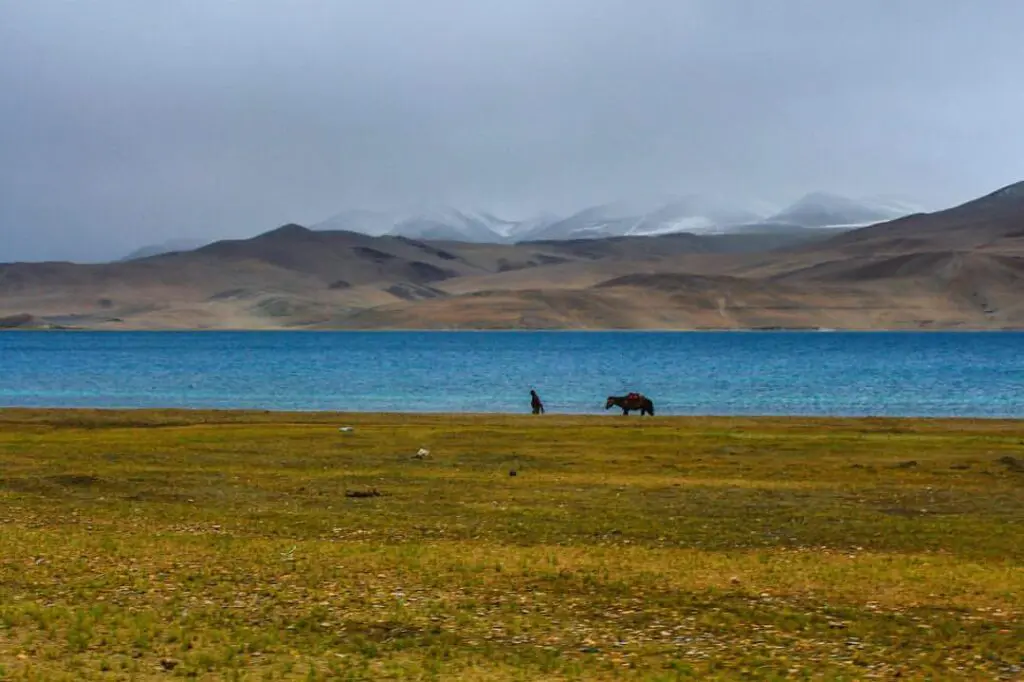
North to south, the lake runs a little past 22 km, with a width of at least 3 km at its broadest stretch. That makes it a fraction of the size of its far larger neighbour, Pangong Tso, which stretches some 135 km. What Tso Moriri gives up in size, though, it makes up for many times over in the quality of what surrounds it.
Why I visited Tso-Moriri?
The real draw, beyond the water itself, is the startlingly green marshland ringing the lake’s northern and southern edges.
A streak of cobalt set against dusty browns would already be striking on its own, but the addition of that green turns Tso Moriri into something more than just another high-altitude lake – it functions as a genuine wetland ecosystem, and that distinction is exactly what pulled me toward the Parang La trek from Spiti into Ladakh one summer.
Every return trip to Ladakh has come with the same instinct: seek out whatever doesn’t show up on a standard Ladakh tour package. Reaching Tso Moriri by the least conventional route available fit that instinct perfectly.
Parang La turned out to be a punishingly long trek – over a week spent consistently above 4,500 m, capped by a crossing of a 5,600 m snow-bound pass.
By the time we made our final crossing of the Pare Chu river, it was already the seventh day of the hike and the fourth since clearing the pass. Tso Moriri was the payoff waiting on the other side of all of it – a bright signal pulling us forward. Crossing that river also meant leaving Himachal behind for Changthang in Jammu & Kashmir, and the shift in landscape was immediate and obvious.
The parched ground and stone gave way almost at once to sprawling green marsh, dotted with pools where wildflowers had taken hold. Further off, larger ponds held flocks of birds, some swimming, others circling overhead.
After fording a handful of small streams threading through the narrow valley toward the lake’s southern edge, we finally reached the grasslands bordering Tso Moriri.
Our camp for the following two nights sat right at the water’s edge, at a spot called Kiangdom – named, fittingly, for the Kiangs, or Tibetan wild asses, that call this stretch home.
I spent the time wandering the grasslands while marmots and kiangs watched from a cautious distance, largely uninterested in me – as were the bar-headed geese, who paid me no mind whatsoever. None of that mattered much; after nine days without seeing anything green, the sheer abundance of life here was a welcome shock to the system.
Across the water, the rounded profiles of Chamsher and Lungser Kangri rose gently into view. Everything felt beautiful again – the sunsets were vivid, the sunrises sharper still, and even the moonrise in this remote corner felt like something rare. Far from any trace of civilisation, this version of Tso Moriri came about as close to paradise as anywhere I’d been.
On the ninth morning since setting out, it was finally time to shake the dust off – literally and otherwise – and start heading back toward civilisation. Korzok, the only lakeside village, sat a solid 20 km away near the lake’s northern end, which meant a long walk along the edge of what felt like a turquoise dream.
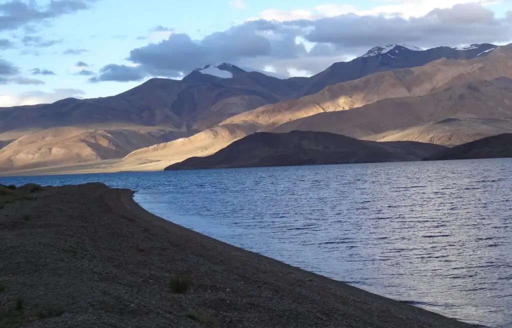
That walk had an odd duality to it – both numbing and completely absorbing at once. Numbing, because covering ground here barely seemed to register: with Chamsher (6,620 m) and Lungser Kangri (6,665 m) rising to the east, Mentok Kangri (6,250 m) to the west, and Spiti’s imposing Gya Peak (6,794 m) anchoring the southern horizon, the scale of everything made individual progress feel meaningless. Neither the lake nor the mountains seemed to shift position no matter how far I walked.
And yet it was absorbing too – walking the shoreline of one of the most striking lakes anywhere, ringed by these enormous peaks, in a solitude so complete it felt like being the sole witness to whatever the water chose to do next.
Every so often, a small cluster of yellow-flowered scrub broke the monotony, and each one brought a small, disproportionate flash of joy – flowers, of all things, out here in the desert.
Small shifts in the scenery – a sudden patch of desert vegetation, or simply noticing how clear the water beside me had become – kept pulling my attention back. The whole stretch from Kyangdom to Korzok played out as a running contest between wonder and fatigue.
There’s something to be said for monotonous walking – it leaves the mind free to drift. On this kind of terrain, there’s little risk of a misstep sending you off a ledge; Changthang simply doesn’t do jagged edges, steep drops, or loose rock. Everything here is smooth and rounded, which meant I could let my thoughts wander while my legs did the work on autopilot. Despite the heat and dust making it feel uncannily like a summer afternoon in the plains of southern India, I slipped into a rare, unburdened headspace, untouched by either the noise of ordinary life or the harshness of the terrain around me.
A Memorable Finale to the Tso Moriri Trek
By day nine of walking through arid, color-saturated mountains, a certain numbness to the beauty had understandably set in. Korzok couldn’t come fast enough – mostly because it meant an end to the dust. After what felt like hours stuck retracing the same stretch of ground, piles of mani stones etched with Tibetan prayers began appearing like makeshift cairns, some scattered right into the shallows. Eventually, a distant mound topped with prayer flags came into view. Distance and time both stretch strangely at altitude, and it took far longer than expected to actually reach it.
Once there, surrounded by stacked cairns, with Gya Peak standing steady behind me and the hazy outline of Korzok ahead, the end finally felt close. That’s when the gratitude hit – this was the same spot I’d stood at five years before, unsure of what came next. This time, I already knew. Sometimes things really do come full circle.
Parang La Trek to Tso Moriri: Know Before You Go
This stretch was part of a 10-day Parang La trek running from Kibber to Korzok. End to end, Tso Moriri runs at least 20 km length wise, a stretch that took roughly 8–9 hours to cover on foot. The entire route sits above 4,500 m, with no shelter and no water source along the way.
Temperatures in Changthang can be misleading – afternoons may climb as high as 35°C, while the same night can drop well below freezing. This hike is best attempted only once you’re properly acclimatized to the altitude.